On 17th August, the UK military successfully launched its inaugural
Earth-imaging satellite, named Tyche. The satellite was lifted into space
aboard a SpaceX Falcon rocket from California at 11:56 local time (19:56
BST). “Tyche, UK Space Command’s first satellite, is now in space,”
the UK Space Command commented on X. “Congratulations to @UKSpaceCmd and
@SurreySat...
The post UK Launches First Military Earth-Imaging Tyche Satellite To
Enhance Space Capability appeared first on Orbital Today.
https://orbitaltoday.com/2024/08/19/uk-launches-first-military-earth-imaging-tyche-satellite-to-enhance-space-capability/View article
View summary
#^UK Launches First Military Earth-Imaging Tyche Satellite To Enhance Space CapabilityOn 17th August, the UK military successfully launched its inaugural Earth-imaging satellite, named Tyche. The satellite was lifted into space aboard a SpaceX Falcon rocket from California at 11:56 local time (19:56 BST).
“Tyche, UK Space Command’s first satellite, is now in space,” the UK Space Command commented on X.
Tyche, UK Space Command's first satellite, is now in space 
It's also @DefenceHQ's first fully owned Earth Observation satellite and the first satellite to be launched as part of Programme ISTARI
This explainer outlines what Tyche can do, and how it fits into Programme ISTARI pic.twitter.com/d7rOrMxxSz — UK Space Command (@UKSpaceCmd) August 17, 2024
“Congratulations to
@UKSpaceCmd and
@SurreySat on the successful launch of Tyche. Satellites play a crucial role in the UK’s defence and security, as well as in connectivity, climate monitoring and economic growth,” the
UK Space Agency commented on the post.
Tyche Satellite To Observe Military On Earth
The Earth-imaging satellite is about the size of a washing machine. It is designed to support military operations from orbit and will be able to identify troops and vehicles on the battlefield.
Tyche will achieve sub-1m resolution. Credit: SSTL
Tyche will orbit Earth at an approximate altitude of 500 kilometres. The satellite is anticipated to function effectively for at least five years.
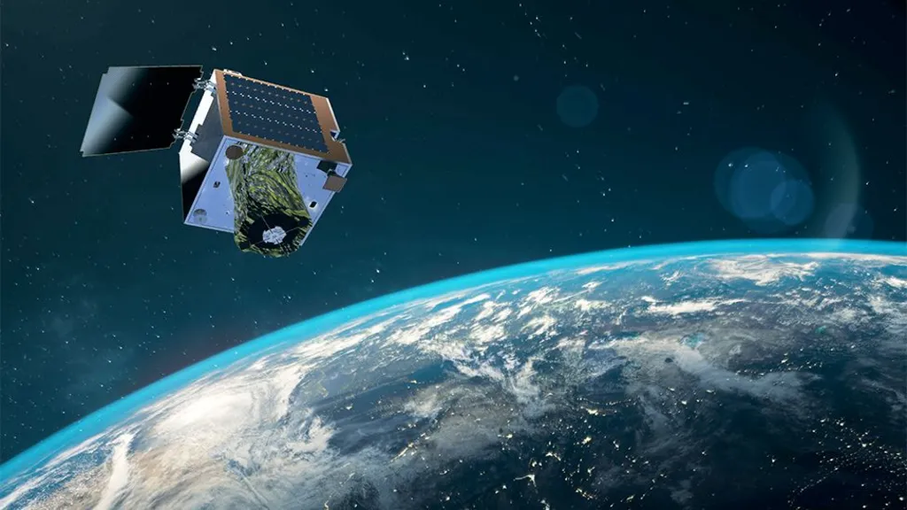
Tyche will collect images from an altitude of 500 km. Credit: SSTL
This demonstration satellite is the first in a planned network for this decade. Future satellites will be equipped to see through clouds and intercept radio transmissions.
Tyche Satellite’s Notable Feature
One notable aspect of Tyche is its propulsion system, which uses water for manoeuvring. Chief Technology Officer Andrew Haslehurst explained that the water is heated to create superheated steam, providing the thrust needed to maintain the satellite’s position. Tyche carries 10 litres of water, which should last for five to seven years in orbit.
UK’s First Own Imaging Satellite
UK forces have long relied on their advanced satellite communications system,
Skynet, but have mostly needed to request surveillance and reconnaissance imagery from allies, especially the US. While the Ministry of Defence (MoD) has previously funded UK commercial space projects, Tyche marks its first entirely owned imaging satellite.
Construction And Costs Of Tyche Satellite
The Tyche satellite was built by Surrey Satellite Technology Ltd (SSTL) and commissioned by UK Space Command. It weighs 160kg and orbits about 500km above Earth. Tyche takes images in visible light, like what we see with our eyes, capturing areas up to 5km wide with a resolution of 90cm. While not the most advanced in detail compared to some US satellites, it meets the British military’s needs.
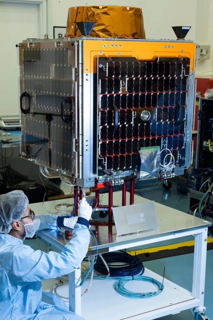
Credit: SSTL
Tyche is based on the Carbonite model, which is quick to build and relatively inexpensive. The Tyche contract is worth £22 million.
The satellite was developed following a 2021 Space Command Paper and the 2022 Space Defence Strategy, which committed the previous government to invest £970 million over ten years into the Intelligence, Surveillance, Target Acquisition, and Reconnaissance (ISTARI) program.
The plan included several early research and development projects. Its goal is to eventually launch a network of military and security satellites into orbit.
SSTL And ISTARI Program
SSTL has been working with UK Space Command on the ISTARI program and aims to win more defence contracts at home and abroad. Darren Jones from SSTL mentioned that many countries are starting their own space programs, creating a global demand for space defence. The Tyche contract shows that the UK Ministry of Defence trusts SSTL to handle these missions. This, in turn, could help them secure future international deals.
Maj Gen Paul Tedman, commander of UK Space Command, mentioned, “The space defence strategy outlines how we will become a meaningful space power by 2030. We hope to see many more satellite launches in the coming months and years. Tyche is the beginning of that.”
The post
UK Launches First Military Earth-Imaging Tyche Satellite To Enhance Space Capability appeared first on
Orbital Today.
